About Shoreline Publishing's Aerial Photo Cards & Custom Prints


Shoreline Publishing prints and distributes aerial photocards and photo prints for those who kayak, fish, boat, and enjoy Texas coastal and inland waterways.  There are no better maps available to view shorelines, bayous, lakes, flats, etc.

 Photocards can come with kayak trails and geographic names of bays, lakes, rivers, cuts, channels, etc.  Most have a compass rose and scale. 

Shoreline also offers large photo prints of selected bay systems.  Prints range from 42” to 96” wide and are laminated.  Mounting and framing services are available.

Custom aerial prints of ranches, developments, and other large pieces of property are a specialty of Shoreline.  A CD of the property is provided with each print.


Home ~ Photocards ~ Standard Photo Prints ~ Custom Prints ~ Shoreline Dealers ~ Purchase

PR Department ~ Contact ~ Links ~ About Our Products

Privacy Policy | Product Guarantee-Shipping

© 2007 - 2017 Shoreline Publishing, All Rights Reserved
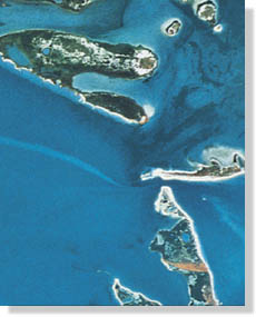
Shoreline Publishing prints photomaps, photocards and custom aerial photo prints of areas including bays, rivers and inland waterways.  Maps include value-added features such as kayak trails, launching locations,  and geographic names such as bays, bayous, lakes, points, reefs, etc. Natural and historical information.  Texas coastal areas include Armand Bayou, West Galveston Bay, Christmas Bay, Drum Bay, East Matagorda Bay, Matagorda Island, San Jose Island, West Matagorda Bay, Port O’Connor, San Antonio Bay, Carlos Bay, Mesquite Bay, Redfish Bay, South Bay, Lighthouse Lakes, Brown & Root Flats, Mustang Island. River paddling trails include San Marcos River at Luling, Colorado River at Columbus and the Colorado River at Bastrop. Aerial mosaics are extremely detailed and show structures not seen on traditional charts and fishing maps.  Shoreline Publishing also produces aerial prints of farm, ranches, developments, lodges and land anywhere.